Four Maps Showing U.S. Expansion West And South
From Its Initial Eastern 13 Colonies on the Atlantic Only
Bordered on North By British Territory,
on the South and West, by Spanish Territory
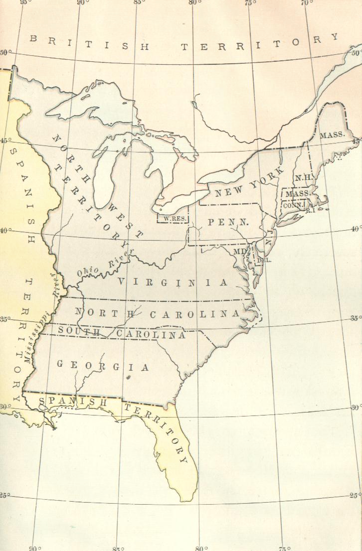
1. U.S. 1783
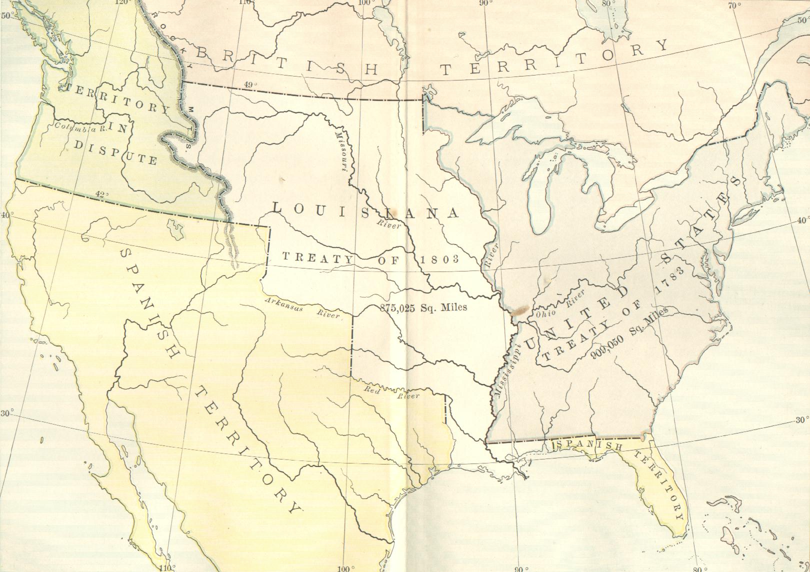
2. U.S. 1803 (After Louisiana Purchase)
The Term "Spanish Territory" Means Mexico
The Term "Disputed Territory" Means Canada
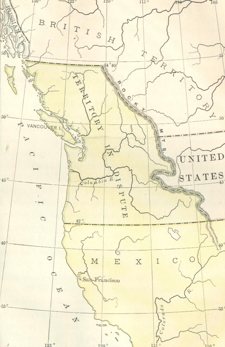
3. Western U.S., 1845, Showing
Canada - Mexico Contiguous
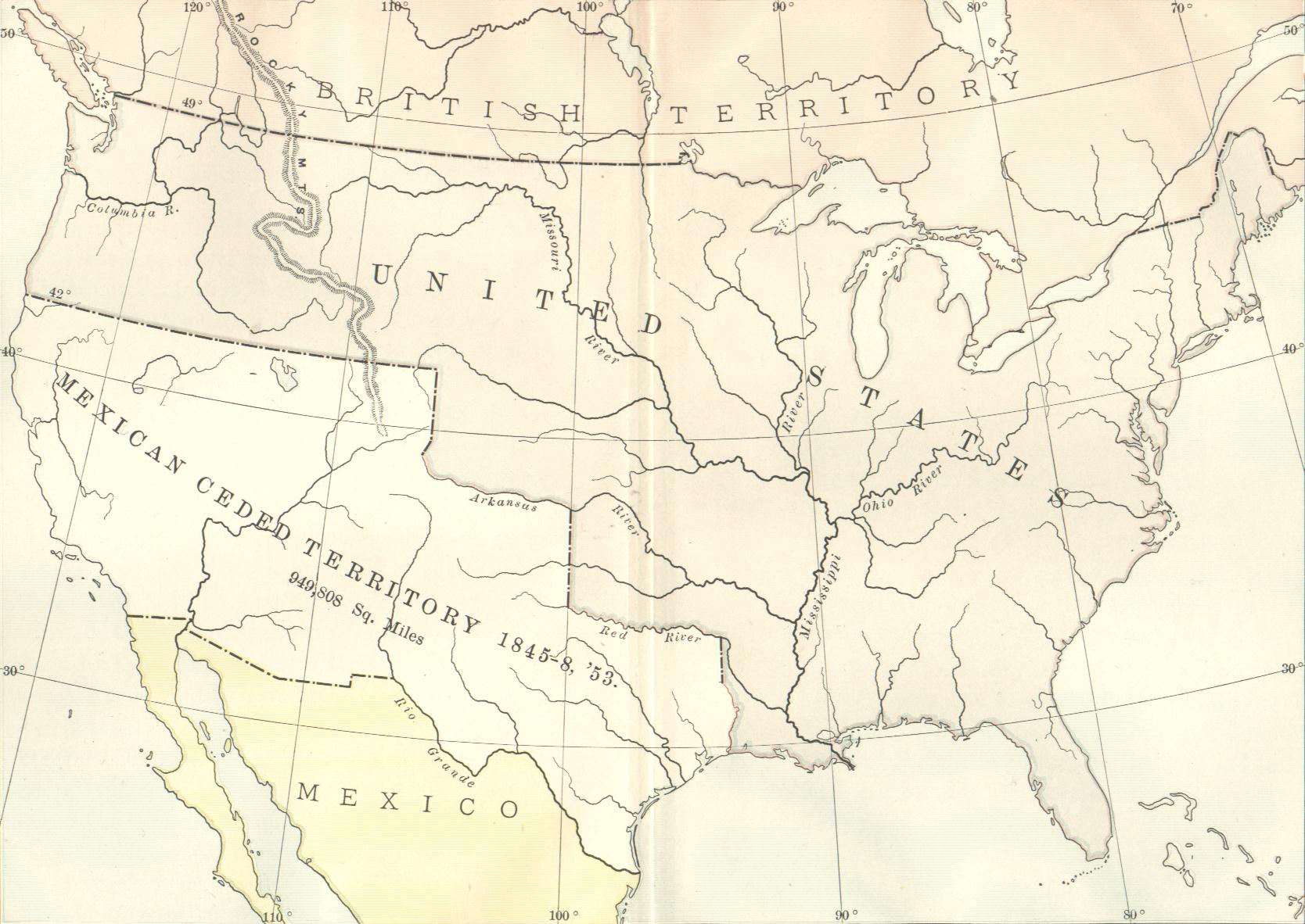
4. U.S. 1853, after 1846-1848 War
of Aggression Against Mexico,
Taking All of Northern Mexico,
Leaving Less Than Half Still "Mexico"
For information on the U.S. War of Aggression Against Mexico, see references including
Rev. Parker Pillsbury, Church: Forlorn Hope of Slavery (Boston: A. Forbes, 1847), pp 58-68
Rev. William Goodell, Slavery and Anti-Slavery (New York: William Harned Pub, 1852), pp 272-305
Vice-President Henry Wilson, History of the Rise and Fall of Slavepower in America (Boston, 1877), pp 127-138. |